


GMaps is a powerful Android app designed to provide advanced tools for land surveying, mapping, and geographical measurements. It is an ideal solution for professionals such as surveyors, agriculturists, and resource managers, as well as casual users seeking accurate mapping capabilities. With its range of high-precision features, the app supports efficient land measurement, coordinate data management, and GPS-enabled navigation.
Advanced Mapping and Surveying Tools
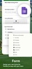
The app offers precise tools for land area and distance measurement, allowing you to plan and manage terrain with confidence. Additionally, it supports coordinate capture, enabling you to add various types of coordinates and build a personal database. Its customizable forms allow effective survey data logging, while unit conversion functionalities enhance convenience by quickly adapting to different measurement systems.
Collaboration and Export Options
Collaboration is made seamless with the ability to work on maps and surveying projects with your team. Moreover, GMaps supports exporting survey data in widely used formats, including KML, GeoJSON, and Excel, providing the flexibility to integrate data into other platforms or workflows effortlessly.
User-Friendly Features for Navigation and Data Management
Navigation is simplified with a high-precision compass and GPS map camera that displays coordinates directly on maps. Supporting various coordinate types such as latitude/longitude, UTM, and DMS, the app ensures adaptability for diverse mapping needs, making it a reliable tool for both professional and personal use.
Experience precise mapping and surveying with GMaps, tailored to help you manage land data with accuracy and efficiency.
Requirements (Latest version)
- Android 7.0 or higher required
Comments
There are no opinions about GMaps yet. Be the first! Comment